The first trip of 2023 at long last. 8th to 11th June. It was also a "shakedown cruise" as both Teria and skipper have been ashore far to long and there were a few new boat additions to sea-trail as well.
Day1: After reading all the signage (crocodile habitat, port extension works, marine park zones etc) launched Teria at Ross River boating park ramp ok and motored over a quiet spot upstream to anchor overnight. I like the flat waters on the river, very few other boats and a just a few seabirds on the river bank.
 |
| Launching depth for trailer and boat |
 |
| Launching ramp and pontoon |
 |
| Mast down portable anchor light rigged |
Tried the Aust volunteer Coast Guard's "trip log" mobile app for the first time. At Coast Guard they can then see all the planned trip details on their computer.
It was the first sea test of the Garmin fishfinder and handheld GPS chartplotter, both worked well. Also the first sea test of the Huntingford Helm Impeder, it kept the boat on course while on the foredeck while anchoring. Also first trip out for the Dometic 33L cool-ice esky with 4-day ice holding.
 |
| Fish finder/depth sounder (and esky's) first trip out |
 |
| Handheld GPS chartplotter with bracket mount, first trip out. The blue area indicates a shallow tidal zone. |
The electronic chart on my GPS, has all the navigation beacon lights and navigational hazards on it. This is great if selecting a new anchorage area, the GPS chart shows where any rocks, reefs, wrecks or undersea cables or pipelines are located, so they can be avoided. The zoom function can be used to get a good look. leave my GPS bracket unsecured while moving, as the GPS is designed to be handheld to operate and see the small chart screen. After use i stow the GPS on its bracket. It's portable and floats, so can be used on other small craft like dinghy's.
Day 2: The millpond waters, mossie net and coil made for a sandfly free good sleep onboard.
 |
A good mosquito net over the hatch is needed in tropical mangrove creeks
|
Another first use item for me. Activated another Coast Guard mobile phone App called "Safe trx". It plots your GPS position every minute or so on "Google maps", and coast guard base can follow your exact path/position in real time. It's good for when on the move between destinations, so long as you have mobile phone signal.
 |
| Glassy waters at Sunrise on Ross River |
 |
| Quiet part of Ross river, Mt Stuart (VHF repeater on top) |
Motored out past the cabin-cruiser moorings and past the port bridge to re-anchor, slowly raise the mast and setup sails etc.
Townsville Port's extension was well underway. The rockwall is far longer and the new wall is also a bit higher than the original ones. It forms a huge sea-pond which is being backfilled by dredge sediment from the main access channel expansion (wider and deeper, for bigger ships).
 |
| Calm morning for motoring, Townsville and Castle Hill astern |
It was flat calm on Cleveland Bay at mid morning. After an hours motoring it was unusually calm still, so changed plan a bit and set course for Cape Cleveland lighthouse. It's normally in a difficult upwind position from Townsville, but conditions were perfect to reach it around noon time. Teria was cruising along at 5.1 knots, over a flat sea-grass seabed just 15 - 25 feet below. Spotted the water swirl from either a sea-turtle or dugong which feed on the seagrass meadow below.
Also wore my new PLB in a waist-bag at all times while the boat is moving offshore. Read of a life-saving rescue of a solo sailor in a very remote region, only the PLB alerted and guided SAR crews to him in the middle of the sea. He would've been lost and drowned without it. Hope it's never needed.
The seabreeze began to come in when 20 minutes from the Cleveland lighthouse, however this was ok as the sizeable hills of Cape Cleveland kept the waves down in their lee.
Anchored for lunch and a rest near the high tide. The depth sounder and GPS chart helped find the best anchoring location and safe depth. (The tide was falling, so these two navigation aids prevent getting stranded by the tide in unfamiliar waters)
 |
| Cape Cleveland hills and lunch anchorage |
 |
| Cape Cleveland historic lighthouse |
Hauled the kayak onboard and stowed on foredeck (always do for rougher sailing legs) Set full sail and course for Magnetic Island, now about 10 miles downwind. The wind was about 10-15 knots SE so made good speed. Passed an empty bulk carrier ship, floating high on it's marks, it was one of two waiting to enter port. The sounder saying it was about 16m deep, (the deepest water on the whole trip). It also indicated that the seafloor is very flat overall around Cleveland bay.
 |
| Heading westward on a nice broad reach |
 |
| Magnetic Island on the port bow |
 |
| The bimini shades the cockpit while keeping an eye on the anchored ship |
 |
| Bulk carrier at anchor |
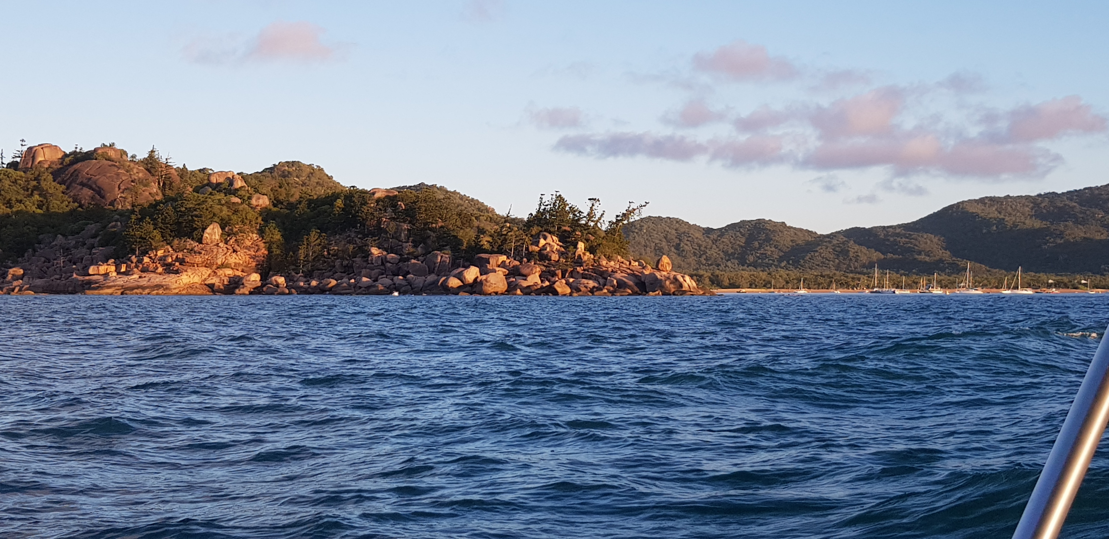
The sun was low in the west and lit up the granite hills of Magnetic Island brilliantly. About 20 or more yachts/vessels were anchored in Horseshoe bay, so carefully sailed in past them and found an open area among the shoal draft vessels (Catamarans and cabin-cruisers) closer to shore. Logged off the "Safe Trx" app after anchoring safely.
 |
| The hills of Magnetic Island on approach from South to Horseshoe Bay |
 |
| A fleet of cruising yachts, cabin cruisers and a few trawlers anchored at Horseshoe bay. |
A golden-red sunset backlit the fleet with their masthead anchor lights on for the night (my anchor light is setup in the rigging, relatively low at about 6ft above deck, next to the mast - but reckon it's a good spot for any yacht's dinghy crew to see in the dark) Moon rise was around 11pm, so there was a good night-sky of stars.
 |
| The "Evening Star" - Planet Venus is the first celestial body to show at dusk |
 |
| Horseshoe Bay anchorage, masthead lights |
 |
| The cockpit galley - Trangia, LED lantern and sink bowl. |
Most of my dinner food for the trip was pre-cooked, packed into plastic containers and stowed in the esky. The Trangia 27 spirit cooker re-heated dinner and still had plenty of fuel in it's burner to boil a couple of kettles of hot water for the thermos and a hot milo. Simple but effective. A small plastic bin with a recycled bread bag was good for any rubbish generated aboard.


No comments:
Post a Comment